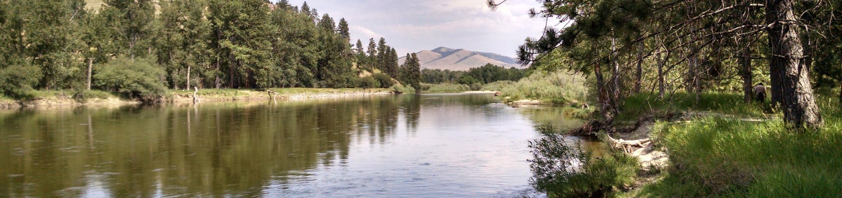
Floodplain Mapping Update: Clark Fork River, Bitterroot River, Rock Creek
Missed the open house?
No worries. Click here to view the the open house displays. Missoula County Floodplain Administration staff are available for one-on-one appointments. Scheduling an appointment is encouraged to make sure the right staff are available.
To make an appointment or ask questions ahead of time, please contact county staff at 406-258-4657 or floodplain@missoulacounty.us. Members of the public interested in property within city limits, not under county floodplain jurisdiction, should contact City Floodplain Administration at 406-552-6625 or zoningdesk@ci.missoula.mt.us.
Missoula County is working with the Federal Emergency Management Agency (FEMA) and the state Department of Natural Resources and Conservation (DNRC) to update floodplain maps for the Clark Fork River, the Bitterroot River and Rock Creek.
The floodplain and rivers are natural systems that change over time, and the new maps are intended to provide more reliable and detailed information about areas prone to flood hazards. Updated floodplain maps will depict the latest, most accurate flood risk data, and will eventually replace the existing floodplain maps, which are based on data from the 1970s.
Following a public engagement period, Missoula County will need to adopt regulations that reference the new maps for residents in the floodplain to be eligible to buy flood insurance through the National Floodplain Insurance Program. Residents will not be eligible for this program if the County does not adopt the regulations. Additionally, adopting the regulations ensures Missoula County is eligible to receive federal assistance in the event of a major flooding disaster. If the County does not adopt the regulations, it wouldn’t be eligible for federal funds, and recovery costs would likely fall to local property taxpayers. Adopting the regulations also will ensure Missoula County bases future land-use decisions on the most accurate data.
Additionally, adopting these maps ensures Missoula County is eligible to receive federal assistance in the event of a major flooding disaster. If the County does not adopt the updated maps, it would not be eligible for federal funds, and recovery costs would likely fall to local property taxpayers. Adopting the new maps also ensures Missoula County bases future land-use decisions on the most accurate data.
Who will be affected?
Residents who live in near these waterways in the following areas may see changes to the floodplain maps. Property owners who will potentially see changes will receive a postcard about the updated maps.
- Bonner/West Riverside
- Clinton
- East Missoula
- Frenchtown
- Lolo
- Orchard Homes
How will the maps change?
The new maps are based on more accurate data and the updated modeling better identifies which properties are at risk of flooding. Properties that weren’t shown to be in the mapped floodplain, may now be based on this updated information. Homeowners should check with their lender or insurance agent after the maps are finalized by FEMA.
After the maps are finalized by the Federal Emergency Management Agency, Missoula County will be required to regulate any new development in the floodplain. Examples of these requirements include elevating the structure, using flood-resistant building materials and installing flood vents. While Missoula County recommends property owners in the floodplain take mitigation measures to protect their property, they will not be required to unless they plan to alter, substantially improve or replace a structure.
New preliminary floodplain maps were released by FEMA and DNRC, they include some changes from the draft maps that were available from 2022 until recently. Changes include floodplain designations near the Orchard Homes Levee and various areas of connectivity to meet FEMA mapping standards). Missoula County and the city of Missoula will be conducting outreach this fall and will host open houses this winter to share these maps prior to the official appeals period and adoption of regulations that reference the maps for use in floodplain development review.
Recently, questions about the floodplain mapping process have circulated in the community. Missoula County values the discussion and interest in the process. The questions section compiled below includes clear facts, references, and resources. Staff are happy to provide additional information and welcome any follow-ups the community may have.
View the Maps
Why hasn’t the county provided property-specific paper maps to the public and affected landowners?
The planning office is the official floodplain map repository for Missoula County and is open to the public for this purpose. Printed maps are available upon request. The county has committed to providing additional notice to all potentially affected property owners to make sure that those who need information about the changes in the floodplain maps have access to it. Sending a map with the FEMA floodplain designations to each affected landowner would be expensive and would confuse many landowners without additional context and explanation. Floodplain administration staff routinely help provide this information and are a resource for the public to navigate the FEMA flood hazard determinations. This is why we have hosted open houses and are making individual appointments with property owners.
What climate change effects were considered during floodplain mapping and classification?
The floodplain study is a snapshot in time using climate data up until the study date. Future climate change and river channel migration is not considered in these FEMA floodplain maps. While we recognize this is a drawback, it does reinforce the need to continually update flood hazard information over time as the hydrologic cycle and landscape changes.
How are groundwater issues considered?
Missoula County is concerned about adverse impacts caused by groundwater to both structures and septic systems. Site development reviews often identify potential effects of high groundwater. These issues can include crawlspace flooding and damage to subgrade enclosures. Groundwater is not often covered by the National Flood Insurance Program, and this adds to the importance of mitigating high groundwater by elevating mechanical equipment and avoiding construction of subgrade enclosures in susceptible areas.
Why are different floodplain designations applied to properties in the same neighborhood?
The floodplain mapping is based on fine scale variation across the landscape, such as the ground elevations at a specific site compared to how much a river or stream is expected to rise in the 100-year flood. This will result in different floodplain designations in a single neighborhood because even a difference of a few inches can result in land being affected by floodwater.
How are changes in snowpack, precipitation, temperature and snowmelt considered?
The new FEMA floodplain study includes updated hydrology reflecting the amount of water during different flood scenarios. Current hydrology information, including seasonal water content, results in updated floodwater discharge volumes.
How is land classified in the floodplain when it is above a river?
Although some land next to the river will be above the ordinary high-water mark or even dry during seasonal runoff and certain flood events, this land can be below the elevation that FEMA has determined will be under water in a flood event, with a peak discharge that has a 1% chance in any given year.
Does Missoula County determine property values?
No, the Montana Department of Revenue determines taxable property values.
Does city annexation affect floodplain designations?
No, both the city and county are undergoing the same map update from FEMA. Floodplain management and regulations differ between the city and county, so check with the appropriate jurisdiction for specific property questions.
Are the floodplain maps based on historical flooding?
Historical flooding and local context may be referenced by FEMA and summarized in a Flood Insurance Study when preparing new floodplain maps. However, the flood study is based on probability of severe flooding based on calculated hydrology and hydraulics. An area with a 1% chance of flooding may experience a flooding event in subsequent years, or not at all over decades. Rivers and the water cycle change over time, and flood events over 100 years ago are not a major factor in establishing updated flood risk maps.
What are the septic system requirements for properties added to floodplain?
Sanitation facilities and septic systems are overseen by the Missoula Public Health department and environmental health staff. Septic systems in the floodplain can pose significant public health risks. Replacement of existing or failed systems in the floodplain need to meet standards to ensure there will be no adverse impacts. Check with environmental health for a specific property.
Can Highway 200 at the bottom of brickyard hill be an accredited levee?
No, the highway was not built to FEMA levee standards, and it is not feasible to retrofit it to meet these standards.
What flood mitigation is the county implementing to help property owners?
Missoula County promotes retrofitting existing structures, encouraging individual property owners to adequately insure their assets against flood risk, and requiring property owners to complete development in the floodplain to ensure it is reasonably safe from flooding.
What financial assistance is there for people in the floodplain?
Flood insurance through the National Flood Insurance Program is the best way to protect from the financial losses associated with flooding. Additional grant or assistance opportunities can be available through the NFIP. Post-disaster financial assistance to communities and individuals can also be made available to communities that participate in the NFIP.
Why is land that is separated from the river by an elevated road or railroad bed shown as in the floodplain?
Floodplain maps are created by FEMA to model the surface flow of floodwater in in the 1% annual chance flood event. Only a levee that has been accredited through the NFIP will be factored into the model for withstanding base flood forces. Other non-levee features, such as an unaccredited levee system, highway or railroad berm, are not recognized as providing adequate protection in the base flood. In particular, roads and railroads are constructed with gravel or rock bases to permit transfer of water, so the soil is not saturated. This prevents issues like frost heaving, for example. There are also drainage systems designed for interstate highways and other travel routes, such as culverts and drainage basins, to allow stormwater or floodwater through. We can expect the water to pass through many of these features and as a result, we cannot expect a railroad, highway or other non-levee feature to provide safety in the base flood. While some degree of protection may exist and can be recognized in how the floodway boundary is drawn, residents behind these features should be aware of the flood risk.
How does county participation in the Community Rating System (CRS) work?
The Community Rating System (CRS) is a voluntary incentive program that recognizes and encourages community floodplain management practices that exceed the minimum requirements of the National Flood Insurance Program (NFIP). More than 1,500 communities participate nationwide. In CRS communities, flood insurance premium rates are discounted to reflect the reduced flood risk resulting from the community’s efforts that address the three goals of the program: 1.Reduce and avoid flood damage to insurable property 2.Strengthen and support the insurance aspects of the National Flood Insurance Program 3.Foster comprehensive floodplain management Missoula County is currently rated at Class 7, which equates to a 15% discount on NFIP flood insurance for anyone in the county. A few examples of the county’s activities that are credited include (1) updating a pre-disaster mitigation plan to keep our community disaster ready and resilient, (2) notifying property owners who live in areas that suffer repetitive flood damage about opportunities through the NFIP, (3) maintaining construction elevation certificates and map information so the public can access property details, and (4) ensuring permitted structures are reasonably safe from flooding through the review of floodplain development permits.
Does the Community Rating System (CRS) lead to increased regulations?
Not necessarily. Participation in CRS does not automatically lead to increased regulations. The CRS program recognizes that standards that are higher than the minimums required by FEMA are often adopted by communities to better reduce flood damage and protect public health and safety. The state of Montana (and therefore communities participating in the NFIP) has adopted two important standards that are higher than the minimum required by FEMA: 1) requiring two feet of freeboard and 2) mapping that is limited to allowing one half-foot floodway surcharge.
What is the timeline for Missoula County review of the new maps?
The timeline for final adoption is under the purview of FEMA. As a participating community in the NFIP, the County will eventually receive a letter from FEMA with notification of the effective date and a statement that the County has six months to incorporate the maps into regulations as a condition for staying in the NFIP. There are several steps before we get to that point, such as a comment and appeals period, and potential regulatory adoption by the County, all of which hinge on the Department of Homeland Security (DHS) and FEMA communicating with the County about the timeline. Once we have more information, we will provide a more detailed timeline.
How does the county regulate land use in the floodplain?
The floodplain regulations apply to an area referred to as the regulated flood hazard area. This is the area in the county that would be subject to flood hazards based on effective FEMA maps and studies. The purpose of these regulations is to promote public health, safety and general welfare, to minimize public and private flood losses in areas subject to flood hazards, and to promote wise use of the floodplain. A floodplain development permit is required for certain activities in the floodplain, such as building a structure or installing utilities, to ensure that the development is completed in a way that is reasonably safe from flooding. In areas covered by the Missoula County Zoning Resolution originally adopted in 2022 for the Missoula urban area (see map), there may be additional regulations in place that apply to development in the floodplain and riparian areas. The County’s property information desk (zoner@missoulacounty.us and 406-258-4642) is the best resource for getting information about county zoning. General information about planning for new construction in the county and county permitting can also be found at www.MissoulaCounty.BUILD.com. In addition to county regulations, other state and local regulations may apply to development of land in or near a floodplain such as 310 Permits, which are administered by the Missoula Conservation District.
What are the different roles of FEMA, DNRC and the County when it comes to floodplain maps and floodplain regulations and how does oversight of the floodplain program work?
The flood hazard maps and studies are created and published by FEMA. These undergo multiple internal reviews to check for errors or refinements before becoming draft, preliminary and effective. The comment and appeal period is also overseen by FEMA. Minimum standards are also established by FEMA in the code of federal regulations. Communities are required to adhere with FEMA requirements for regulations as a condition of being in the NFIP. The decision to finalize maps that have implications for insurance regulations is solely with FEMA. FEMA ultimately provides oversight of local government floodplain programs. Communities that do not meet obligations such as incorporating new FEMA maps or regulations can be placed on probation or suspension. The DNRC Floodplain Management Program serves as a technical resource for communities to navigate the complexities of NFIP participation. These resources include (1) community assistance in permitting and regulations, training and outreach, (2) property owner resources such as flood insurance information and property owner resources, (3) technical resources for floodplain managers such as the floodplain mapping program, and (4) community resilience resources such as planning and responding for disasters and recovery and stream restoration. The County is tasked with managing flood-prone areas and communicating about flood risk to the public. Mapping, permitting, insurance and mitigation are the cornerstones of a community program whose purpose is to protect public health, safety and welfare. The County does not create the floodplain maps, nor does it decide whether the maps are to become final for insurance purposes. The County promotes flood insurance but does not manage any insurance policies or receive any financial resource based on insurance policies.
Can Missoula County adopt floodplain regulations that are more stringent than the minimums set by the state and/or federal government and, if so, what is the process for this and has it happened?
Yes, the County can adopt higher regulatory standards. The process is to propose regulations with higher standards and obtain approval by the DNRC and FEMA. The County then conducts outreach and ultimately posts public notice. The commissioners then hold a public hearing to consider adopting the regulations. Here are two examples from Missoula County: 1) requiring engineered foundation walls for homes and 2) prohibiting new levees and rip rap in most situations.
When is a property owner required by law to have flood insurance?
Flood insurance is a legal requirement for a home purchase when the home is in the FEMA-designated 100-year floodplain and is being financed with a federally backed mortgage. FEMA enforces this, not the County.
In the event that I need to file a claim related to flood insurance, will it cover everything?
Flood insurance policy holders should speak with their insurance agent for specific flood insurance questions. A claim can cover many things; however, there are coverage limits. Information about flood insurance can be found at floodsmart.gov. For a complete list of what is and isn’t covered, review the Summary of Coverage guide: https://agents.floodsmart.gov/sites/default/files/media/document/2025-07/fema-nfip-summary-coverage-brochure-12-2023.pdf
-
Podcast episode: Why should you care about the floodplain?
Share Podcast episode: Why should you care about the floodplain? on Facebook Share Podcast episode: Why should you care about the floodplain? on X (formerly Twitter) Share Podcast episode: Why should you care about the floodplain? on Linkedin Email Podcast episode: Why should you care about the floodplain? link
Missoula County residents are lucky to live in proximity to multiple rivers and creeks, but this also means increase risks of flooding. Missoula County is currently working with both state and federal agencies to update floodplain maps for the Clark Fork River, the Bitterroot River and Rock Creek. But what exactly is the floodplain, and why are updated maps needed?
Recently, the Missoula County commissioners spoke with Matt Heimel, floodplain administrator for Missoula County, and Adriane Beck, director of the Missoula County Office of Emergency Management. Adriane and Matt answer these questions and help decode the many acronyms around the floodplain mapping process.
Click here to listen to the episode, or find it wherever you get your podcasts under "The Agenda with the Missoula County Commissioners".
Who's Listening
-
Planning, Development and Sustainability

Phone 406-258-4657 Email floodplain@missoulacounty.us -
Planner/Floodplain Administrator
Missoula County Planning, Development and Sustainability

-

-

FAQs
-
 General
-
Floodplain Open House Update
- Why hasn’t the county provided property-specific paper maps to the public and affected landowners?
- What climate change effects were considered during floodplain mapping and classification?
- How are groundwater issues considered?
- Why are different floodplain designations applied to properties in the same neighborhood?
- How are changes in snowpack, precipitation, temperature and snowmelt considered?
- How is land classified in the floodplain when it is above a river?
- Does Missoula County determine property values?
- Does city annexation affect floodplain designations?
- Are the floodplain maps based on historical flooding?
- What are the septic system requirements for properties added to floodplain?
- Can Highway 200 at the bottom of brickyard hill be an accredited levee?
- What flood mitigation is the county implementing to help property owners?
- What financial assistance is there for people in the floodplain?
- Why is land that is separated from the river by an elevated road or railroad bed shown as in the floodplain?
- How does county participation in the Community Rating System (CRS) work?
- Does the Community Rating System (CRS) lead to increased regulations?
- What is the timeline for Missoula County review of the new maps?
- How does the county regulate land use in the floodplain?
- What are the different roles of FEMA, DNRC and the County when it comes to floodplain maps and floodplain regulations and how does oversight of the floodplain program work?
- Can Missoula County adopt floodplain regulations that are more stringent than the minimums set by the state and/or federal government and, if so, what is the process for this and has it happened?
- When is a property owner required by law to have flood insurance?
- In the event that I need to file a claim related to flood insurance, will it cover everything?

