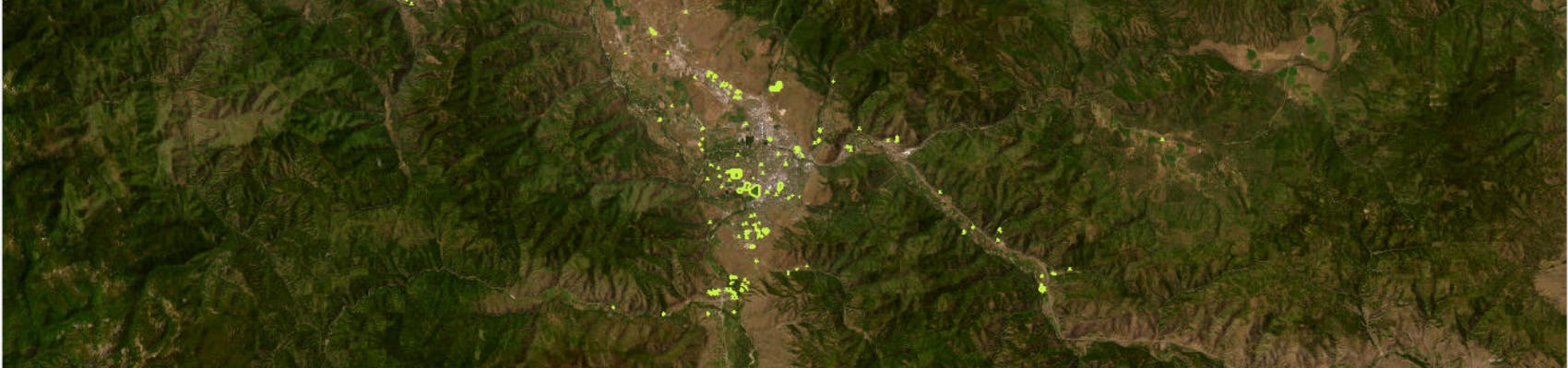
Lands Inventory Map
Explore Missoula County’s lands inventory map.
This map is more easily viewable on a computer or tablet. The map can be difficult to navigate on phone screens.
Lands are assessed based on six factors:
- Topography assessment: slope, floodplain, stormwater utility and parcel size
- Built Environment assessment: right-of-way/utility easements, existing structures, zoning, and public water and sewer access
- Administrative assessment: necessity for conducting countywide government operations
- Conservation assessment: natural resources, open space, wildlife habitat, agricultural and viewshed
- Recreation assessment: public reach, access, investment and redundancy for facilities like playgrounds, sports, shelters, dogs, gardens, walking, etc.
- Cultural assessment: historic significance, promotion of arts, education, heritage and human connection
Lands are assigned a number ranging from 0 to 3 on each of these factors, zero being less restrictive to new use and three being more restrictive.
Keep in mind that parcel assessments of 1s and 2s needed and received the most attention and discernment by staff. We anticipate those assessments to generate the most robust community discussion and feedback as this project moves forward. This is a fluid tool, and assessments will be updated regularly as factors change and new information is collected.
Also, parcel boundaries for the Lands Inventory are drawn according to property ownership lines as designated in Montana Cadastral. Parcel boundaries may not be the same as the boundaries of parks, trails and other open space, which can extend across multiple property lines, both public and private.

Thank you for your contribution!
Help us reach out to more people in the community
Share this with family and friends