Missoula County Lands Inventory, Assessment and Strategic Plan
Explore the lands inventory map, read the project narrative and give us your feedback on the inventory and assessment. The County will make updates based on suggestions from the community.
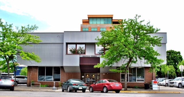
The Department of Land and Economic Development (LED) was created in 2021 to implement strategic initiatives that enhance community vitality associated with economic growth throughout Missoula County as well as guide land development/redevelopment efforts for County properties. As one if its first initiatives, Missoula County commissioners assigned LED to conduct a holistic inventory and assessment of every County-owned property and provide them with strategic policy and use recommendations.
Staff collected factors on each property from a variety of sources to assess development suitability and address other questions about County-owned land. Because land is a finite natural resource, made especially scarce in our geographically constrained county, competition for the most “important” value and subsequent use can be fierce, and emotions can occasionally run high.
LED staff strived to be as objective as possible when choosing and evaluating factors, while seeking to honor previous engagement and planning efforts that articulated community values.
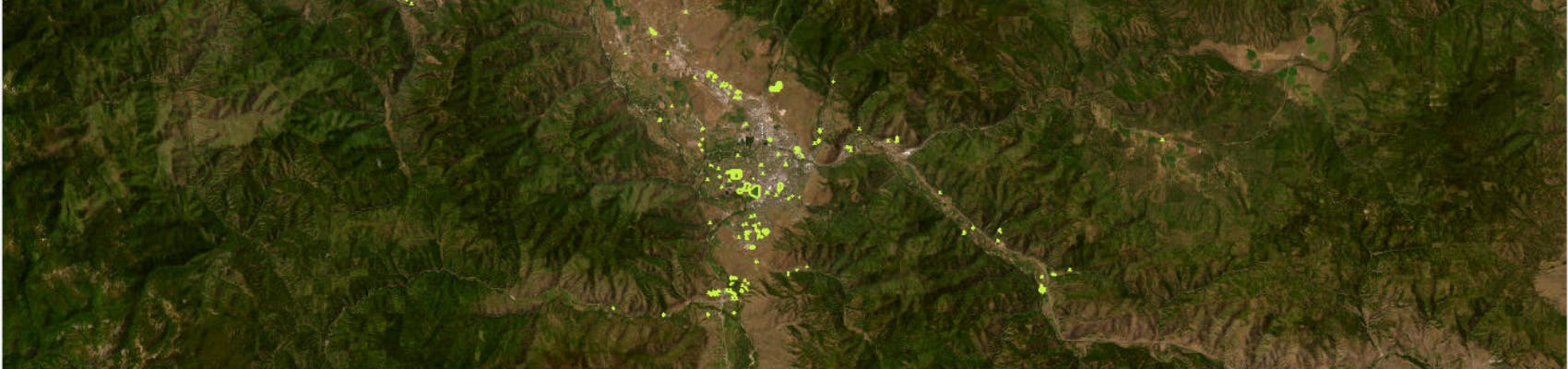
After reviewing over 260 parcels owned by Missoula County, LED staff worked with the Geographic Information Systems Department to create an interactive mapping tool to display all properties in a holistic and concise format to minimize both misinformation and fragmented debate.
Staff want to ensure the foundation of the project is solid before exploring recommendations. Explore the lands inventory map, read the project narrative and give us your feedback on both the inventory tool and the assessments. The County will make updates based on suggestions from the community.
Once the tool is established, LED staff will use it to create strategic land use, management and policy recommendations for commissioner approval and staff implementation. However, no tool is perfect. Parcels within a sorted group will be reviewed carefully, and some parcels will likely be removed before that group is presented as a recommendation. We expect draft recommendations to be published late fall 2023.
Please keep in mind parcel boundaries for the Lands Inventory are drawn according to property ownership lines as designated in Montana Cadastral. Parcel boundaries may not be the same as the boundaries of parks, trails and other open space, which can extend across multiple property lines, both public and private.
Explore the lands inventory map, read the project narrative and give us your feedback on the inventory and assessment. The County will make updates based on suggestions from the community.
The Department of Land and Economic Development (LED) was created in 2021 to implement strategic initiatives that enhance community vitality associated with economic growth throughout Missoula County as well as guide land development/redevelopment efforts for County properties. As one if its first initiatives, Missoula County commissioners assigned LED to conduct a holistic inventory and assessment of every County-owned property and provide them with strategic policy and use recommendations.
Staff collected factors on each property from a variety of sources to assess development suitability and address other questions about County-owned land. Because land is a finite natural resource, made especially scarce in our geographically constrained county, competition for the most “important” value and subsequent use can be fierce, and emotions can occasionally run high.
LED staff strived to be as objective as possible when choosing and evaluating factors, while seeking to honor previous engagement and planning efforts that articulated community values.
After reviewing over 260 parcels owned by Missoula County, LED staff worked with the Geographic Information Systems Department to create an interactive mapping tool to display all properties in a holistic and concise format to minimize both misinformation and fragmented debate.
Staff want to ensure the foundation of the project is solid before exploring recommendations. Explore the lands inventory map, read the project narrative and give us your feedback on both the inventory tool and the assessments. The County will make updates based on suggestions from the community.
Once the tool is established, LED staff will use it to create strategic land use, management and policy recommendations for commissioner approval and staff implementation. However, no tool is perfect. Parcels within a sorted group will be reviewed carefully, and some parcels will likely be removed before that group is presented as a recommendation. We expect draft recommendations to be published late fall 2023.
Please keep in mind parcel boundaries for the Lands Inventory are drawn according to property ownership lines as designated in Montana Cadastral. Parcel boundaries may not be the same as the boundaries of parks, trails and other open space, which can extend across multiple property lines, both public and private.
-
Lands Inventory Map
Share Lands Inventory Map on Facebook Share Lands Inventory Map on X (formerly Twitter) Share Lands Inventory Map on Linkedin Email Lands Inventory Map linkExplore Missoula County’s lands inventory map.
This map is more easily viewable on a computer or tablet. The map can be difficult to navigate on phone screens.
Lands are assessed based on six factors:
- Topography assessment: slope, floodplain, stormwater utility and parcel size
- Built Environment assessment: right-of-way/utility easements, existing structures, zoning, and public water and sewer access
- Administrative assessment: necessity for conducting countywide government operations
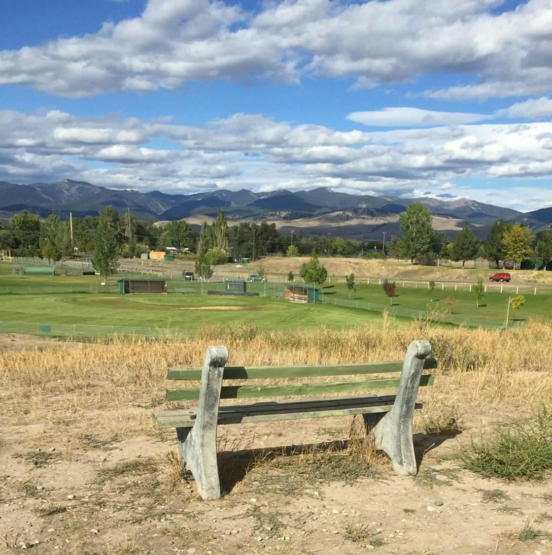
- Conservation assessment: natural resources, open space, wildlife habitat, agricultural and viewshed
- Recreation assessment: public reach, access, investment and redundancy for facilities like playgrounds, sports, shelters, dogs, gardens, walking, etc.
- Cultural assessment: historic significance, promotion of arts, education, heritage and human connection
Lands are assigned a number ranging from 0 to 3 on each of these factors, zero being less restrictive to new use and three being more restrictive.
Keep in mind that parcel assessments of 1s and 2s needed and received the most attention and discernment by staff. We anticipate those assessments to generate the most robust community discussion and feedback as this project moves forward. This is a fluid tool, and assessments will be updated regularly as factors change and new information is collected.
Also, parcel boundaries for the Lands Inventory are drawn according to property ownership lines as designated in Montana Cadastral. Parcel boundaries may not be the same as the boundaries of parks, trails and other open space, which can extend across multiple property lines, both public and private.
Explore Missoula County’s lands inventory map.
This map is more easily viewable on a computer or tablet. The map can be difficult to navigate on phone screens.
Lands are assessed based on six factors:
- Topography assessment: slope, floodplain, stormwater utility and parcel size
- Built Environment assessment: right-of-way/utility easements, existing structures, zoning, and public water and sewer access
- Administrative assessment: necessity for conducting countywide government operations
- Conservation assessment: natural resources, open space, wildlife habitat, agricultural and viewshed
- Recreation assessment: public reach, access, investment and redundancy for facilities like playgrounds, sports, shelters, dogs, gardens, walking, etc.
- Cultural assessment: historic significance, promotion of arts, education, heritage and human connection
Lands are assigned a number ranging from 0 to 3 on each of these factors, zero being less restrictive to new use and three being more restrictive.
Keep in mind that parcel assessments of 1s and 2s needed and received the most attention and discernment by staff. We anticipate those assessments to generate the most robust community discussion and feedback as this project moves forward. This is a fluid tool, and assessments will be updated regularly as factors change and new information is collected.
Also, parcel boundaries for the Lands Inventory are drawn according to property ownership lines as designated in Montana Cadastral. Parcel boundaries may not be the same as the boundaries of parks, trails and other open space, which can extend across multiple property lines, both public and private.
-
Assessments Defined
Share Assessments Defined on Facebook Share Assessments Defined on X (formerly Twitter) Share Assessments Defined on Linkedin Email Assessments Defined linkAssessment areas are listed below from the most objective assessment area (Topographical) to the least objective assessment area (Cultural). A definition is provided for each value assigned (0,1,2, or 3). This glossary is also embedded within the GIS tool.
Topographical Assessment
Parcels were assessed a value of either 0, 1, 2 or 3, with 3 having serious topographical barriers that preclude development and 0 having no topographical barriers to development. Topographical assessment is based on the following factors: slope, floodplain, stormwater utility and parcel size. This value was assessed for all properties.
Topographical Value 0: Parcel size is over 3,000Continue reading
Assessment areas are listed below from the most objective assessment area (Topographical) to the least objective assessment area (Cultural). A definition is provided for each value assigned (0,1,2, or 3). This glossary is also embedded within the GIS tool.
Topographical Assessment
Parcels were assessed a value of either 0, 1, 2 or 3, with 3 having serious topographical barriers that preclude development and 0 having no topographical barriers to development. Topographical assessment is based on the following factors: slope, floodplain, stormwater utility and parcel size. This value was assessed for all properties.
Topographical Value 0: Parcel size is over 3,000 square feet, slope is flat, serves no stormwater management purpose and is out of the floodplain.
Topographical Value 1: Parcel size is over 3,000 square feet, slope is mixed or rolling, out of the floodplain and serves no stormwater management purpose.
Topographical Value 2: Parcel size is under 3,000 square feet, slope is mixed, rolling or flat, out of the floodplain and serves no stormwater management purpose.
Topographical Value 3: Parcel located within the floodplain, is too steep to build or serves a stormwater management purpose; size is not relevant.
Built Environment Assessment
Parcels were assessed a value of either 0, 1, 2 or 3, with 3 having serious constraints and 0 being easily buildable.
Built environment was assessed on the following factors: right-of-way/utility easement, existing structures, zoning, and public water and sewer access. This value was assessed for all properties.
Built Environment Value 0: Parcel has no right-of-way or utility easements, no existing structures, parcel is zoned for development and has public water and sewer access.
Built Environment Value 1: Parcel has no right-of-way or utility easements, may have existing structures on a portion of the property but parcel is large enough to accommodate additional structures, any type of zoning or unzoned, may or may not have access to public water and sewer.
Built Environment Value 2: Parcel has an existing structure on most of the property that makes it unlikely to accommodate additional development, any type of zoning or unzoned, may or may not have access to public water and sewer. No public right of way or utility easement on the parcel.
Built Environment Value 3: Parcel is designated as public right-of-way or has a utility easement.
Administrative Assessment
Parcels were assessed a value of either 0, 1, 2, or 3, with 3 being essential and 0 being irrelevant to the administration of County government. This value was assessed for all properties, regardless of whether the properties have official names or designations.
The administrative assessment assumes that all County departments are equally necessary to fulfilling the County’s mission; however, not all parcels used by County departments are necessary to that departments function.
Administrative was assessed on the following factors: how essential a parcel is to conducting Missoula County operations and how widespread the operations cover. Roads are not assessed in this section; rather, they are assessed under Built Environment.
Administrative Value 0: Parcel does not serve any administrative purpose for Missoula County. This includes parks with no buildings or undeveloped lots.
Administrative Value 1: Parcel may be helpful but is not necessary to conducting County operations, such as an employee-only parking lot that isn’t open to the public.
Administrative Value 2: Parcel is necessary to conducting County operations, but operations do not extend County-wide, such as a community center that only serves one community within the County.
Administrative Value 3: Parcel is necessary to conducting County operations, and operations extend Countywide, ranging from the Courthouse to gravel pits.
Conservation Assessment
Parcels were assessed a value of either 0, 1, 2 or 3 as determined by current or future conservation benefits. This value was assessed for all properties, regardless of whether the properties are officially designated as parklands by state law or by Missoula County’s 2014 Parks and Trails Master Plan.
Conservation includes natural resource benefits, open space, wildlife habitat, agricultural interests and aesthetics. Values were determined based on the following factors: use, uniqueness or redundancy compared to other conservation properties in the area, location, size, configuration, impact from adjacent properties and external factors.
Conservation Value 0: Parcel does not provide notable conservation value.
Conservation Value 1: Parcel has limited natural resource, open space, wildlife habitat, agricultural or aesthetic value.
Conservation Value 2: Parcel has moderate natural resource, open space, wildlife habitat, agricultural or aesthetic value.
Conservation Value 3: Parcel has high natural resource, open space, wildlife habitat, agricultural or aesthetic value.
Recreation Assessment
Parcels were assessed a value of either 0, 1, 2 or 3 as determined by the parcel’s current or future usefulness as a recreation asset. This value was assessed for all properties, regardless of whether the properties are officially designated as parklands by state law or by Missoula County’s 2014 Parks and Trails Master Plan.
Active recreation areas support activities such as playgrounds, sport facilities, dog parks, community gardens, picnic shelters and other similar developed opportunities for recreation enjoyment. Passive recreation areas provide for self-guided, low-impact and unprogrammed activities such as walking, hiking, wildlife viewing, photography, fishing or other similar activities.
The following factors were assessed as part of its recreation value: well-defined recreation, recent capital improvements, public reach, public access, location, configuration, nearby properties, quality of use, redundancy with recreational amenities in the area.
Recreation Value 0: Parcel does not provide notable active or passive recreation value.
Recreation Value 1: Parcel has limited active or passive recreation value.
Recreation Value 2: Parcel has moderate active or passive recreation value.
Recreation Value 3: Parcel has high active or passive recreation value.
Cultural/Historic Assessment
Parcels were assessed a value of either 0, 1, 2 or 3, with 3 being culturally significant and 0 being culturally insignificant. This value was assessed for all properties, regardless of whether the properties have official names or designations.
Cultural value was assessed by the following factors: historic significance, promotion of the arts, education, heritage and human connection.
Cultural Value 0: Parcel does not promote the arts, heritage, education or human connection and has no historic significance.
Cultural Value 1: Parcel has no historic significance. Parcel does promote the arts, heritage, education or human connection. However, the use could be relocated elsewhere and retain its cultural value.
Cultural Value 2: Parcel promotes the arts, heritage, education or human connection and may have historic significance. It is possible but would be challenging to move the use and retain its cultural value.
Cultural Value 3: Parcel has both historic significance and promotes the arts, education, heritage or human connection. The property itself and use would lose their cultural value if relocated.
-
Frequently Asked Questions
Share Frequently Asked Questions on Facebook Share Frequently Asked Questions on X (formerly Twitter) Share Frequently Asked Questions on Linkedin Email Frequently Asked Questions linkWhat questions does the County hope this project will address?
- Does public ownership address a public need, or does private ownership make more sense?
- Is there County-owned land that could and should be used differently? Which properties and how? What are the challenges?
- Is the County the proper owner and steward of neighborhood parks and stormwater facilities within city limits? If not, which properties? What is the process for giving that land to the City of Missoula?
- Does the County use appropriate methodology to acquire and divest of property? What is the legal process? Should the County giveContinue reading
What questions does the County hope this project will address?
- Does public ownership address a public need, or does private ownership make more sense?
- Is there County-owned land that could and should be used differently? Which properties and how? What are the challenges?
- Is the County the proper owner and steward of neighborhood parks and stormwater facilities within city limits? If not, which properties? What is the process for giving that land to the City of Missoula?
- Does the County use appropriate methodology to acquire and divest of property? What is the legal process? Should the County give or trade property? What policy or procedural improvements are recommended?
- Are County properties accurately described on legal documents? If not, which ones? How can this be clarified in the future?
- Is the County taking care of land it owns in an equitable manner? If not, what mistakes can we learn from?
- How has county land banking been used successfully? How and where can that success be replicated?
Is the County considering important public uses for its land other than development as part of this project?
Yes. This project is not exclusive to land development.
The assessments and the factors considered were selected thoughtfully to balance all community needs. Staff went through a meticulous process, striving to be as objective as possible when choosing and evaluating factors, while seeking to honor previous engagement and planning efforts that articulated community values.
The next phase will provide management and policy recommendations designed to improve existing uses as well as create opportunity for land acquisition not necessarily tied to development. Staff and boards that advise on the management of these types of properties will have the opportunity to vet recommendations.
What lands are more developable or less developable, according to this assessment?
The next phase of this project will provide recommendations as to which parcels are developable and which parcels should be improved to become developable in the future.
In order to have a comprehensive understanding of all County-owned land, staff completed assessments for six primary areas related to buildability and community value: Topographical, Built Environment, Administrative, Conservation, Recreation and Cultural.
Assessments from 0 to 3 were then assigned to each parcel in all six areas, 0 being the least restrictive to new use and 3 being the most restrictive to new use. In other words, 3s reflect a high value for a particular area, while 0s indicate no value. If a parcel is assigned a 3 in any area, it is unlikely to be recommended for new use unless that value changes in the future, which is certainly possible as conditions evolve. Likewise, if a parcel received 0s and/or 1s across most areas, it is a good candidate to be recommended for improvement (although that improvement will not necessarily be development). Parcel assessments of 1s and 2s needed and received the most attention and discernment by County staff. We anticipate those assessments, particularly in the more subjective areas, to generate the most robust community discussion as this project moves forward.
How did staff come up with these six areas for ranking the lands?
Staff selected these six areas because together they encompass factors relevant at this time and paint a full picture in a concise and digestible format that reflects community values: Topographical, Built Environment, Administrative, Conservation, Recreation and Cultural.
The factors themselves came from a plethora of sources, including but not limited to Missoula County GIS and Cadastral, City of Missoula neighborhood and public utility maps, FEMA floodplain maps, Missoula County’s 2014 Parks and Trails Master Plan, National Register of Historic Places, as well as interviews with County department-level staff.
Will this project cause the land near my house to be developed?
The next phase of this project will provide recommendations as to which parcels are eligible for new use or management and which parcels should be investigated further and may become eligible in the future.
Most properties owned by the County will remain unaffected, either because they are valuable for conducting government operations or have physical constraints. If a parcel has a high recreational, conservation, cultural or administrative value it will likely remain in its current use. However, the tool is fluid – as conditions evolve, assessment values of parcels may also change.
Keep in mind that just because a parcel is recommended for new use or management doesn’t mean that it will be developed. For example, a County-owned park that only serves a single neighborhood may be recommended for divestment to that Homeowner Association to manage.
Will Larchmont Golf Course be developed into housing?
Community interest in the land inventory project piqued in November 2021 when a private developer approached the County to propose a large land trade. In exchange for the 152-acre Larchmont Golf Course, the County would obtain 157 acres of land the developer owned off Highway 93 south of Missoula. The commissioners ultimately shelved the proposal and instead directed staff to proceed with the already planned assessment of County properties to holistically determine if there is opportunity to use them for more public benefit.
Under current conditions, Larchmont is unlikely to be recommended for development because it has a high recreational and moderate cultural value. However, if those values change because of evolving conditions, like if a redundant golf course were built, it could become a good candidate for development.
Learn more about the Larchmont proposal.
Want to learn more? The recording of the presentation to the Missoula County Commissioners on April 19, 2023, titled "Missoula County-owned Land Inventory, Assessment, and Strategic Plan Project Overview" is available online.
Signup Banner
Who's Listening
-

Phone 406-258-3175 -

Phone 406-258-3707 -

Phone 406-258-3444
Follow Project

Timeline
-
Identify County-owned properties
Missoula County Lands Inventory, Assessment and Strategic Plan has finished this stageReview all County-owned parcels and determine what level of undertaking this project requires.
-
Create map and assess land
Missoula County Lands Inventory, Assessment and Strategic Plan has finished this stageEstablish factors for assessing properties. Create mapping tool to display and filter assessments. Draft narrative. Assess parcels in six primary areas.
-
Engagement on assessment
Missoula County Lands Inventory, Assessment and Strategic Plan has finished this stagePublish narrative, mapping tool and assessment. Solicit feedback from the community. Edit narrative, mapping tool and assessment based on feedback.
-
Form recommendations
Missoula County Lands Inventory, Assessment and Strategic Plan is currently at this stageUse mapping tool to filter parcels to make policy and land use and management recommendations. No tool is perfect. Some properties will likely be removed from groups before recommendations are brought forward.
-
Engagement on recommendations
this is an upcoming stage for Missoula County Lands Inventory, Assessment and Strategic PlanPublish draft recommendations. Solicit feedback from the community. Edit the recommendations based on community feedback.
-
Implementation
this is an upcoming stage for Missoula County Lands Inventory, Assessment and Strategic PlanIf the Board of County Commissioners adopts the recommendations and direct staff to implement them, staff would draft policies as well as land use and management recommendations for the commission’s further approval.
Key Dates
-
April 19 2023