Pathways and Trails Masterplan
Missoula County commissioners voted to adopt the final Pathways and Trails Master Plan at their Thursday, Dec. 1, 2022, public meeting.

Missoula County commissioners voted to adopt the final Pathways and Trails Master Plan at their Thursday, Dec. 1, 2022, public meeting.
Planning regional bicycle and pedestrian connections!
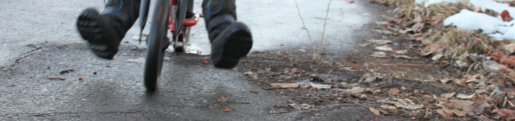
The Pathways and Trails Masterplan will direct development and ongoing maintenance of paved pathways and trails to increase active transportation in Missoula County outside Missoula city limits.
Pathways and trails include shared-use paths (paved routes that are separated from roadways), major sidewalks outside of Missoula's urban core and similar active transportation facilities.
What is the plan? The Missoula County Pathways and Trails Masterplan is a long-range planning tool to determine gaps and identify opportunities for improvements. It is a visionary document that sets the values and goals for future investments, an opportunity for staff and the public to weigh in on the future of pathways and trails in the county, and a fresh look at regional bicycle and pedestrian connections outside the City of Missoula. This plan has a specific focus on the county's rural communities.
The resolution of intent for this plan was adopted on Thursday, Oct. 27. The final public hearing of the Pathways and Trails Masterplan will take place at 2 p.m. Thursday, Dec. 1, at the commissioners' meeting. Find the commissioners' public meeting link.
Please note: We heard from a number of residents in support of the Butler Creek Trail Project and urging a re-evaluation of its ranking within the plan; specifically related to traffic safety and as a fire evacuation route (resiliency). Staff reviewed the comments and concur that the ranking should be increased from a resiliency standpoint. The safety criteria is based on crash data and roadway speed. These factors did not warrant a change related to the safety evaluation, given this same criteria is applied across all trail projects within the plan.
Who's Listening
-

Phone 406-258-4964 Email tross@missoulacounty.us

Please don't spend any more of our county tax dollars on building new paved trails. They are an expensive luxury we can't afford. Ever increasing property taxes are a major burden to senior citizens on fixed incomes.
We need more trails as soon as possible. Too many streets are too dangerous due to drivers being distracted and moving too fast. We will reiterate, however, that we need to move away from asphalt and concrete trails. These are toxic, related to cancer and increase climate change. Natural surface trails are the best, and can also combine with various packed gravels and natural binders. The City now considers many natural surface trails to be accessible for all. Further, we need to stop spraying toxic herbicides anywhere near trails. 'Yes' to trails, 'no' to asphalt, concrete and spray poisons.
We need to move away from asphalt and concrete trails. Both are toxic to people and the environment. Natural surface trails, pine resin, decomposed granite and other methods are best for walk and bike trails. Regarding intersections, the modern single lane roundabout is at least 100x safer than stop lights, according to numerous studies. For grade separation, going under a road is typically much cheaper and more usable- a bike/ped overpass must go up nearly 20' while a bike/ped underpass needs to go down only 9' (or 8' or 10' depending on the context). When going under a street, then keeping a view of the horizon on the other side is important. There are many natural grade changes existing throughout the valley/county that make for suitable 'under passes.' Thanks for the work, and please start implementing trail connections. Bob Giordano, Director, Missoula Institute for Sustainable Transportation, mist@strans.org
Re: Butler Creek trail.
The Butler Creek trail association already has grands and funding over 140 K ready to go for a project.
My husband and I live in west pointe subdivision which with Circle H neighborhood as well has expanded 60+ homes in the past few years.
Concern as there are no shoulders on the road and sight lines are challenging at best. Sidewalks are GREATLY needed!!
Considering the fiscal year, we are in good shape to warrant sidewalks and shoulder expansion hands down!
I am strongly urging you to consider building the Butler Creek Trail. I have lived in the West Pointe Subdivision for 17 years and am an avid runner. I have found Butler Creek to be very dangerous as there is virtually no shoulder. The Hanson Family has graciously donated a portion of their land for this use, the Butler Creek Trail Committee has already raised $140,000 in grant money and we have an additional 60 homes in our neighborhood. I strongly urge you to please consider the building of this new trail! Many bikers use this road, families with small children walk their children to DeSmet School in strollers and it is simply not safe! Please take this in to consideration as you plan for future trails in our beautiful city! Thank you!
L-1 Farm Lane will be the access for 600 plus students beginning in 2023. Imagine 20K plus cars heading north in the morning rush and the same amount beginning around 3 p.m., combined with 100+ cars trying to access Farm Lane. In addition to wide path or sidewalk a light is needed. Probably a design study should be examined. Students will access the school from the Mormon Creek area and the Hill (2/3rds of the students) Tyler and Glacier Drive are tight residential streets with out sidewalks.
L-2 Lewis and Clark is okay check to see if there is a subdivision planned for that area
Mormon Creek - 1/3 of the students live in that area, It has needed a path for the last 35 years.
Lakeside and Tyler no sidewalks just fog lane. The county did widen the fog lane pre-pandemic which helped but students still use the traffic lanes.
Miller Creek Trail and Bridge - DNRC said no more bridges when we were planning the Lolo to Missoula Multi-use Trail; then there is an eagle nest that was too close to the planned Trail area, northside of the river has flood plain issues and is a spring nesting area for some of the water birds. Thanks, Jean Belangie-Nye
I live in the WestPointe neighborhood at the base of Butler Creek. Considering our neighborhood is built on a steep hill and there is no real open space to play, my husband and I regularly walk our two young daughters, ages 1 and 4, from our neighborhood over to DeSmet to utilize the playground. In it’s current state, we are forced to walk on the road or just off the side in the grass if we aren’t pushing a stroller or pulling a wagon. A safer, paved path to make this trip would be so valuable to families like ours as well as the plethora of bikers that leverage that road to get to the Butler Creek recreation area. Please consider reprioritizing this pathway, especially since there is a good amount of funding already raised as well as land being donating to ensure this project comes to fruition. Thank you for consideration!
We have lived in the West Pointe Development for three years. Due to the increased traffic & fast speed on Butler Creek Road, we have stopped cycling & walking along the road. Even driving onto Butler Creek Road from Mac Arthur Drive has become more dangerous.
There are ready funds & a donation from the Hansen Ranch to build a trail system along the Butler Creek Road. Both West Pointe & Circle H folks, plus other people who enjoy biking & walking, would enjoy enhanced safe trails. This would definitely be an improvement to our city & county.
Thank you for an opportunity to provide comment.
Marianne
My wife and I have lived at West Pointe for 12 years. We bike and walk along Butler Creek. The road is narrow and has no shoulders. We need to have the proposed Butler Creek trail constructed. It will improve pedestrian and bikers using this road. The subdivision is growing quickly with over 40 new units built in the last 18 months. Many of these new residents are young professionals, some with families. Now is the time to create the infrastructure current demand and future growth. Users include staff from the USFS facility at the airport and employees of businesses in the Industrial Park. New housing developments are being planned adjacent to Desmet School. This will include affordable housing for young families who will use this proposed trail. The Hansen Ranch has provided access along their property on Butler Creek. This project needs to be moved up in the priority for your agency and I believe there is still money available from the 2008(?) Open Space Bond Issue for trails.
I believe the West Point HOA could provide a connection from the subdivision to the proposed trail. I believe our committee would be willing to make a presentation to the County Open Space Advisory Committee so they're aware of the need.
Our Subdivision will be experiencing heavy truck and construction activities for many years into the future as they build out the remaining Phases of our Subdivision. Let's get ahead of this now. Waiting will only exacerbate the problems.
Thank you for the opportunity to review and comment on the draft Pathways and Trails Plan. As a non-profit organization, Butler Creek Trail Association's mission is to organize stakeholders and fundraise for a shared use path along Butler Creek Road. We appreciate the chance to review Missoula County’s plan before it becomes final, and as you will see below we would like to request several of the criteria used in ranking the Tier 1 paths be re-evaluated for Butler Creek Trail. In most instances we feel that the assessment failed to use ‘objective, data driven methods’ in prioritization of the projects as the plan intended, and in others we feel there were ‘technical and professional judgement’ that should have been employed to adjust the prioritization point allocation, as was suggested for the Project Prioritization Matrix on page 70 of the draft plan.
Below is a brief summary of the Butler Creek Trail Association board of directors' comments:
• Safety: Butler Creek Road Trail was ranked in the lowest category. While Butler Creek Road Trail meets the criteria for ‘lack of facility now’ it fails to meet the criteria of within ¼ mile of parallel highs speed road, and within ½ mile of high crash frequency. This criterion should be revisited for the Butler Creek Road Trail for the following reasons:
o The existing road is very narrow with line-of-sight issues, and while the speed limit is 35 mph there are significant safety issues on the existing road, and
o Traffic and recreation use will only be increasing with development ongoing on the individual lots off of Butler View Lane, Circle H, and West Pointe. So, while there is not currently high crash frequency we are trying to be proactive to avoid this in the future. We don’t feel the existing ranking in the draft plan adequately reflects the safety hazards on the road, current level of recreation use, and fails to capture the increased safety risks with additional traffic from the developments occurring from this area now. We’d welcome the opportunity to demonstrate this to whomever is interested with pictures, video or a site visit.
• Improves Access: Butler Creek Road Trail again was given the lowest score in this category. This ranking should be higher for the following reasons:
o The project would connect West Pointe, Circle H and other homes along Butler Creek to DeSmet School. Further, in our discussions with DeSmet School they not only support the project but intend to use the trail for physical education along with their annual Butler Creek Boogie (annual running event that currently occurs on the road).
o Additionally, there are Forest Service lands a short distance from where this preliminary phase would terminate on the north end. The road from the end of this preliminary phase to the Forest Service land is gravel, and much wider and safer to recreate on than the narrow, asphalt section of Butler Creek Road which would be addressed by the proposed project. Thus, the proposed path would improve connectivity to Forest Service lands. These lands and the network of roads on them are currently used by mountain bikers to connect Butler Creek road to Grant Creek Trail currently.
o Finally, the southern end of the trail would not only connect to DeSmet School but also the Missoula County Parks’ shared use paths that weave through the commercial and light industrial areas along Expressway. The existing ranking severely underscores the Butler Creek Trail Road concept in this criteria. In a similar light, in Appendix B the Butler Creek Road Trial concept is identified as a ‘seperated’ path and this fails to recognize the connection with the Missoula County Parks path along Expressway.
• Connectivity & Resiliency: Butler Creek Trail again was given the lowest score in this category. The scoring for this criterion should be higher as the proposed path would:
o Address a gap identified on page 43 of the plan,
o Improve connectivity to the Forest Service lands to the north, through the increasingly difficult conditions along the southern portion of Butler Creek Road, and
o Will be located on an evacuation corridor with one-way emergency access from I-90 to the Forest Service gate. It seems the project would meet all three of the criteria evaluated, and this needs to be revisited and re-ranked in a final draft.
• Environmental & Fiscal Assessment: Butler Creek Trail was given the lowest score in this category. It appears that the criteria do not allow for any consideration of the fact that BCTA has been awarded $140,000 (which we estimate is 10% of the overall cost of the preliminary phase) for construction of this preliminary phase of the path through a combination of Recreation Trails Program (RTP) and Montana Trails Stewardship Grant (MTSG) awards. Further, the landowner (Hanson Ranch) has not only provided a right-of-way for the Trail but has donated this land, a minimum of 30 feet buffer along nearly two miles of the road, which accounts for approximately 10 acres of land. Paul and Maggie Hanson are not requesting any form of compensation for the easement and by not accounting for this in the fiscal assessment ranking, the plan is discounting their significant individual contribution to the residents of Missoula County. Additionally, Missoula County Public Works has agreed to relocate the Butler Creek Road to assist with the construction of the trail. Again, the commitment of funding from Public Works is not accounted for in this fiscal assessment. We request this criterion be revisited and revised accordingly in a revised draft.
The ranking and criterion for the Butler Creek Road Trail should have been adequately addressed in this draft given the level of communication we’ve had with your department over the past few years, along with the information we’ve provided to the consultants working on this plan. However, we are grateful to have a chance to review and correct these inaccuracies in this initial draft. Please let us know if there are any additional information we can provide to improve the draft plan and correct these inadequacies.
Finally, Travis Greenwalt’s name (representative for Butler Creek Trail Association) is misspelled on both page ii and Appendix A. Thank you again for the opportunity to comment on this draft plan and we look forward to a new, revised, and improved plan that can adequately address these concerns in the near future.
Please Please Please consider making Butler Creek a higher priority. We are a rapidly growing neighborhood and DESPERATELY need walking trails for safety. Our very active community takes advantage of the outdoors and needs to be a safe area to do so. Vehicle traffic has naturally increased and we want to make sure it's a safe area to enjoy our great outdoors.
As a long-time resident of West Pointe in Butler Creek with young children, there are virtually no established safe ways for my family to travel outside of our neighborhood on foot or bicycle as of this writing. Butler Creek Road has no shoulder, 35 mph speed limit, frequently suffers asphalt damage from poor grading/maintenance, and is poorly designed to accommodate either pedestrian or bicycle traffic.The recent and future growth of West Pointe and Circle H Ranch neighborhoods (projected 200+ additional housing units!!!), not including population growth further north up Butler Creek, necessitates that an off-road trail system be implemented and maintained for the safety and mobility of those living in the Butler Creek area. Also, consider that much of the land for such a trail in Butler Creek has been offered by the Hanson Ranch, which would defray much of the typical costs associated with establishing a trail easement. Please do something to help this situation by placing priority on the Butler Creek Trail at this time. Thank you!
2 year resident of West Pointe. We need a safe and thoughtful solution along Butler Creek Road. The land is donated, the funds raised; let's do this!
We moved to the West Pointe neighborhood nearly 2 years ago from Grant Creek. We know from living there and spending many years to get the Grant Creek Trail built, how critical it is to do this in Butler Creek. The connectivity, safety, providing healthy recreation for all ages and abilities is crucial. We have noted so much more activity on Butler Creek road and do bike ourselves but the road is so narrow and has had increased car traffic too. Having a trail connected to Desmet School should be a high priority given the Safe Routes to Schools Program through the Department of Transportation. Please consider this project a priority. Thanks for the opportunity to share comments.
I support the Butler Creek Trail. The road is narrow with line of sight issues, and has seen exponential increase in use by cars, bicycles, and pedestrians in the last few years. Let's not wait for an accident to happen. Please prioritize this project.
I support the Butler Creek Trail Project.
The project would allow people to walk safely in this scenic area!
I am in support of Butler Creek Trail being a priority for further development. As Missoula's population keeps growing/expanding - especially to the north - there will be increased demand and use of this area. Currently, the trail that does exist is not safe or comfortable for recreational use - especially with young children. There absolutely should be safe pedestrian access to Desmet School from the neighborhood in closest proximity to the school (West Pointe), as well. A donor is willing to give land for this project, and a local development group has $140k in grant funding available to support this project.
I live in the West Pointe neighborhood and although I dont regularly walk along butler creek road myself I think a trail is imperative. There have been many times when driving home there are pedestrians walking right on the road as there is no where else to be and if there is oncoming traffic its very dangerous. There are a LOT of walkers in our neighborhood and I think given that the project already has grant funding it needs to be prioritized to ensure those walking are safe.
We live off Butler Creek Road. From previous comments and activities, there is strong support for the trail here. There is a significant and increasingly safety need. At the same time, it is a beautiful area for walking, running and biking and would be a valuable addition to Missoula County’s recreational system Please prioritize the development of this trail.
Hello,
My wife and I live in West Pointe with our kids and dogs. We would love to walk in our neighborhood but don't feel we can safely do so due to the amount of traffic and poor visibility on Butler Creek Rd. We would love an established trail, especially as our sub division grows and more residents move in. This would allow us a safe method of walking our kids to school at Desmet as well.