Missoula County Floodplain Development Permit #25-07
Project Description:
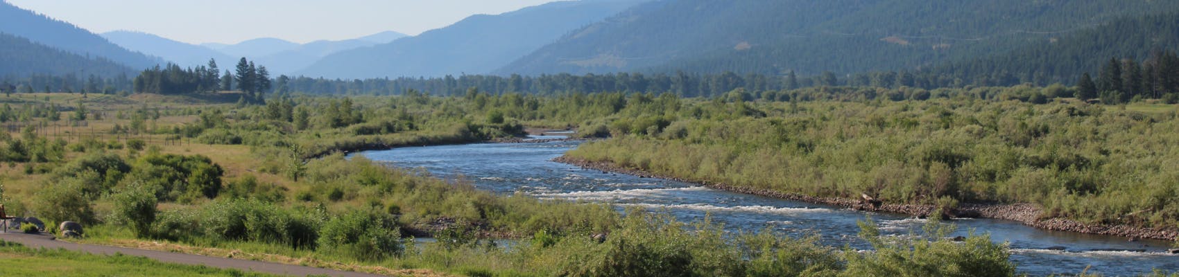
The Missoula County Planning, Development & Sustainability Department (PDS) has received a floodplain development permit application from the City of Missoula for excavation, grading and channel realignment in the Grant Creek regulated flood hazard area. The site is located on multiple parcels, described as Tract 1-A of COS 6916, and Tracts 2,3 and 4 of COS 6758 in Sections 1 and 6, Township 13 North, Range 20 West, Missoula County, P.M.M. Project maps are in the application packet. This is a portion of Grant Creek referred to as “Horseshoe Bend,” southeast of Whippoorwill Drive and southwest of West Broadway in the Sxwtpqyen Neighborhoods Planning Area.

The purpose of this floodplain development permit is to ensure the proposed excavation and channel work complies with the floodplain regulations, which are designed to promote public health, safety and general welfare while minimizing flood-related risks and losses in areas subject to flood hazards and promoting wise use of the floodplain.
The project aims to begin work on realignment of this section of Grant Creek, enhancing floodplain function, restoring channel sinuosity and promoting water quality. This specific permit is intended to allow the contractor to begin excavating the proposed floodplain and channel to ensure the project is completed prior to deadlines for available funding.
There are future processes that will need to be completed, such as a Conditional Letter of Map Amendment (CLOMR) from the Federal Emergency Management Agency (FEMA) that will include additional permit(s) and public participation.
The full application is available for review in the PDS office at 127 E. Main St., Suite 2, in Missoula or online here. Written comments will be accepted through Monday, May 5. Address comments to: Matt Heimel, Floodplain Administrator, Planning, Development & Sustainability, 200 W. Broadway, Missoula, MT 59802. Contact floodplain@missoulacounty.us or 406-258-4657 for more information.
The primary purpose of a floodplain development is to promote the public health, safety and general welfare, to minimize flood losses in areas subject to flood hazards, and to promote wise use of the floodplain.
Missoula County cannot approve a floodplain permit implementing a physical change to the floodplain prior to issuance of a CLOMR by FEMA. That document will be a FEMA letter of approval for a proposed physical change that when completed would propose to change the flood zones, delineation of elevations on the FEMA Flood Insurance Rate Map or FEMA Flood Boundary Map and may amend the FEMA Flood Insurance Study.
The project with this permit is designed to not implement the physical change or include a hydrological connection between the existing channel and proposed new channel. Additional reviews will be necessary as the Grant Creek restoration efforts continue.
Project Timeline:
Public Comment Period: Open through Monday, May 5. The public is invited and encouraged to provide comments and questions for the administrative permit review.
Permit Review Process: Once the application is deemed complete and correct, the floodplain administrator will review the project and determine whether to approve, approve with conditions or deny the permit within 180 days.
Staff Lead:
Matt Heimel
Related Documents & Links:

Thank you for your contribution!
Help us reach out to more people in the community
Share this with family and friends