Sha-Ron Parking Access
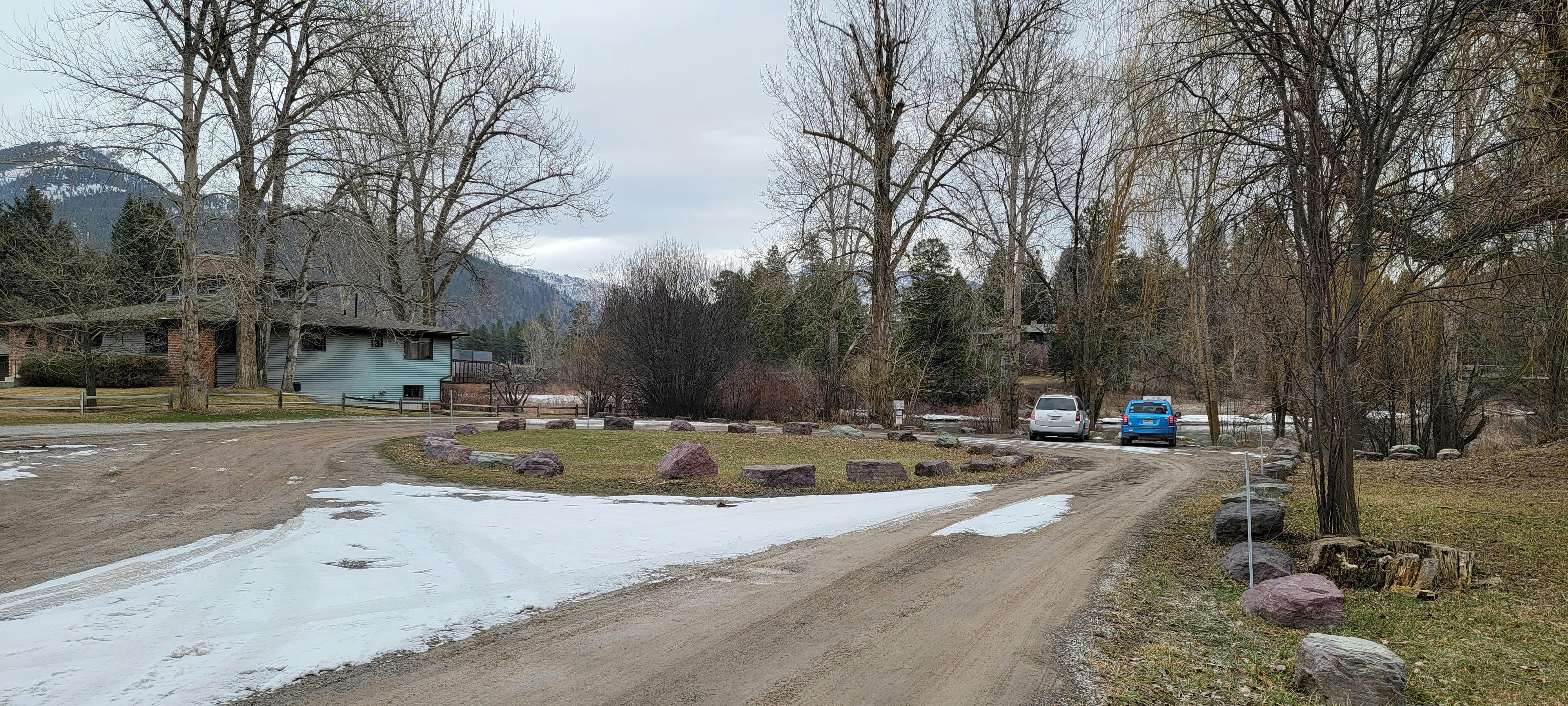
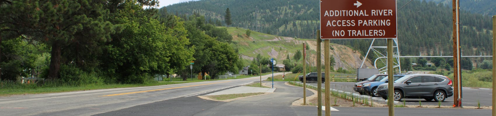
JAG Grading and Paving completed construction on the new parking lot across from Edgewood Drive on Hwy 200 in East Missoula, near the Sha-Ron Fishing Access site in June, and the lot is now open for river users.
On June 8, the commissioners also approved a 'no parking' resolution along Highway 200 near this parking access site.
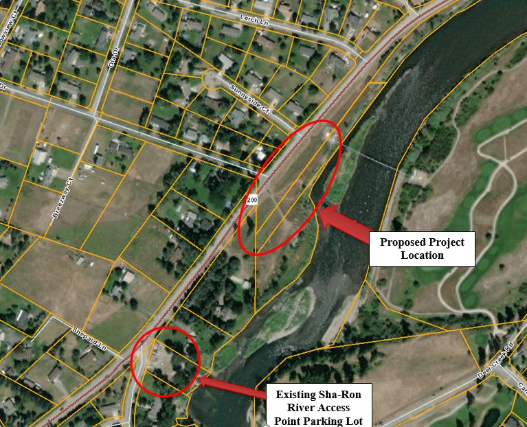
Missoula County built an overflow parking lot and connected a pedestrian trail directly northeast of the Sha-Ron Fishing Access Site on the Clark Fork River in East Missoula. One of the most popular river access sites for floaters, boaters and other recreationalists in the summer, the Sha-Ron Fishing Access Site has a small, 25-vehicle parking lot, so many users parked their vehicles along the shoulder of Highway 200. Though this was legal at the time, it created an unsafe environment for pedestrians and vehicles on the narrow roadway, which has speed limits of 45 and 55 mph.
This project was a collaboration between County departments and Montana state agencies, like Fish, Wildlife and Parks and the Montana Department of Transportation. The new lot holds 68 vehicles, and it connects to the river from the parking lot itself and via a 0.2-mile shared-use path leading to the access at the Sha-Ron Fishing Access Site. The parking area will have bathroom facilities and a new bus stop along Highway 200 between the two parking lot entrances.

Montana Fish, Wildlife and Parks manages the site through a recreation permit issued from the Montana Department of Transportation (MDT), which owns the right-of-way. Missoula County maintains the trail between the overflow parking areas. Mountain Line will maintain the bus stop.
The Montana Transportation Commission determines the speed limit on Highway 200 in close coordination with MDT. The last speed study of this stretch of highway was conducted by MDT in 2019. There was no recommendation then to lower the speed limit; however, the construction of this parking lot may influence people's driving habits enough to provide data that may justify lowering the speed limit in the future. Missoula County did submit a formal request to MDT to complete a speed zone study in November 2022. The study is focused on Highway 200 between East Missoula and the intersection of Tamarack Road/Juniper Drive. MDT will likely complete data collection in this summer and have a complete study and recommendation in late 2023 or early 2024.
View the frequently asked questions in the right sidebar for more information.
JAG Grading and Paving completed construction on the new parking lot across from Edgewood Drive on Hwy 200 in East Missoula, near the Sha-Ron Fishing Access site in June, and the lot is now open for river users.
On June 8, the commissioners also approved a 'no parking' resolution along Highway 200 near this parking access site.
-
Let us know your thoughts on a "no parking" resolution along Highway 200 near the Sha-Ron river access site.
Share Let us know your thoughts on a "no parking" resolution along Highway 200 near the Sha-Ron river access site. on Facebook Share Let us know your thoughts on a "no parking" resolution along Highway 200 near the Sha-Ron river access site. on X (formerly Twitter) Share Let us know your thoughts on a "no parking" resolution along Highway 200 near the Sha-Ron river access site. on Linkedin Email Let us know your thoughts on a "no parking" resolution along Highway 200 near the Sha-Ron river access site. linkMissoula County commissioners opened a hearing on May 25 to consider adopting a 'no parking' resolution for the area along Highway 200 near the Sha-Ron river access site to reduce the risk of people parking along the highway during the season of peak river recreation now that there will be a parking structure to accommodate river recreators. The follow up meeting to make a decision took place on June 8, and the commissioners voted to approve the 'no parking' resolution.
JAG Grading and Paving completed construction on the new parking lot across from Edgewood Drive on Hwy 200 in East Missoula, near the Sha-Ron Fishing Access site in June, and the lot is now open for river users.
On June 8, the commissioners also approved a 'no parking' resolution along Highway 200 near this parking access site.
 2 comments
-
Give us your feedback on the floodplain development permit application
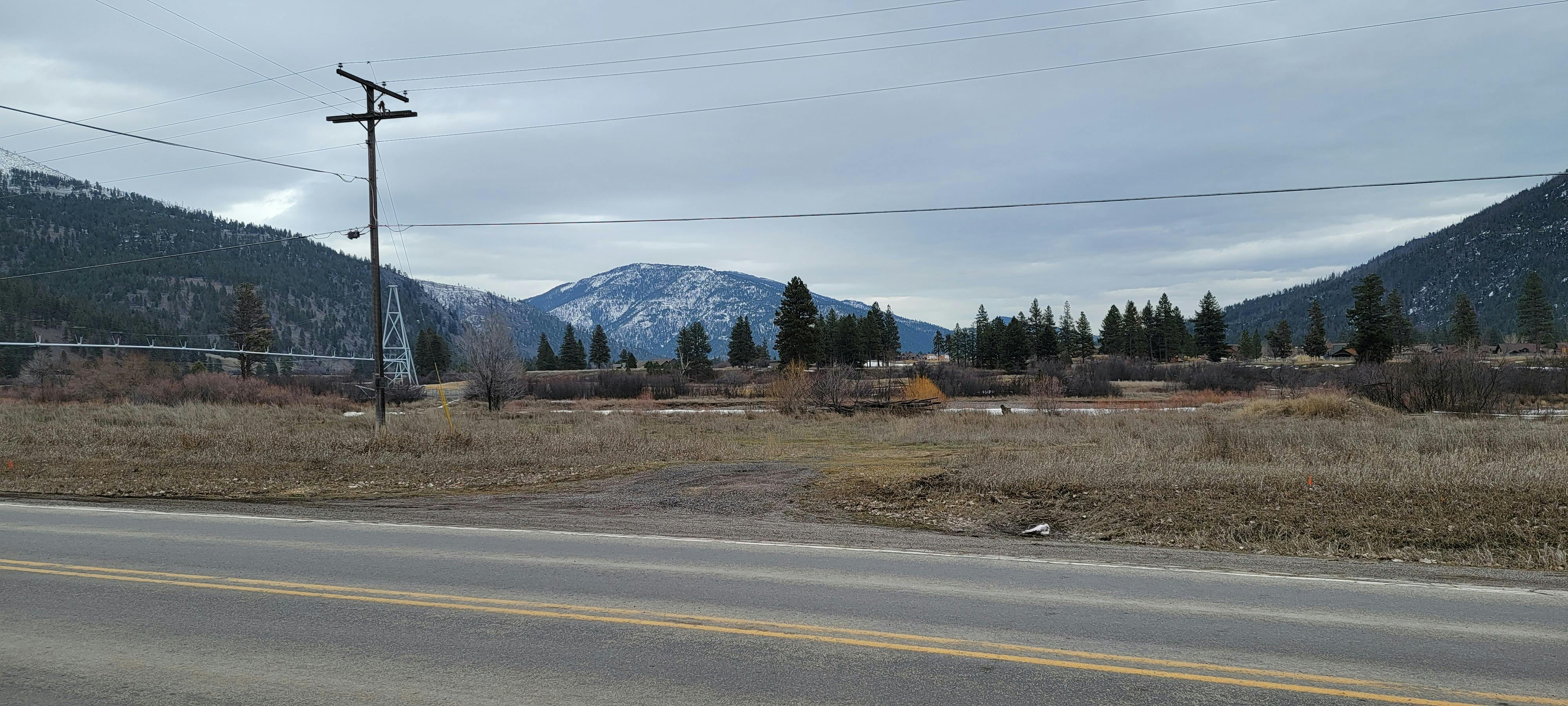
Share Give us your feedback on the floodplain development permit application on Facebook Share Give us your feedback on the floodplain development permit application on X (formerly Twitter) Share Give us your feedback on the floodplain development permit application on Linkedin Email Give us your feedback on the floodplain development permit application linkThis new parking lot is located partially in the floodplain. The Missoula County Planning, Development and Sustainability Department is reviewing a floodplain development permit application from the Missoula County Public Works Department for work within the Clark Fork River floodplain. Public Works’ contractor will pave, grade, place fill and add the river access trail in this floodplain.
The primary purpose of the floodplain development permit is to promote public health, safety and general welfare, minimize flood losses in areas subject to flood hazards and promote wise use of the floodplain.
The comment period for the floodplain development permit application closed on Friday, Feb. 10. Staff from the Planning, Development and Sustainability Office approved the floodplain development permit application. View the approval in the documents.
JAG Grading and Paving completed construction on the new parking lot across from Edgewood Drive on Hwy 200 in East Missoula, near the Sha-Ron Fishing Access site in June, and the lot is now open for river users.
On June 8, the commissioners also approved a 'no parking' resolution along Highway 200 near this parking access site.
-
Share your thoughts on related zoning regulations
Share Share your thoughts on related zoning regulations on Facebook Share Share your thoughts on related zoning regulations on X (formerly Twitter) Share Share your thoughts on related zoning regulations on Linkedin Email Share your thoughts on related zoning regulations linkThe property is split-zoned under the Missoula County Zoning Regulations with Residential Zoning near the road and Resource, Open Lands Zoning near the river. As public agencies, Missoula County and Montana Fish, Wildlife and Parks were allowed to vary from the zoning regulations through a public forum. Pursuant to section 76-2-402, MCA, the Board of County Commissioners held a public hearing on Oct. 27, 2022, to hear all comments and questions. Find the response letter from the involved agencies about the zoning compliance on this land.
JAG Grading and Paving completed construction on the new parking lot across from Edgewood Drive on Hwy 200 in East Missoula, near the Sha-Ron Fishing Access site in June, and the lot is now open for river users.
On June 8, the commissioners also approved a 'no parking' resolution along Highway 200 near this parking access site.
 2 comments
Who's Listening
-

Phone 406-258-4818 Email sstack@missoulacounty.us -

Phone 406-258-4981 Email ccrowser@missoulacounty.us -

Phone 406-258-4818 Email jmitchell@missoulacounty.us
Documents
-
 Floodplain development permit application (30 MB) (pdf)
-
Zoning compliance response letter (294 KB) (pdf)
-
Floodplain development approval (457 KB) (pdf)
-
Design of Sha-Ron Parking Lot (5.48 MB) (pdf)
-
Speed Study Request - Hwy 200 - 2022 (210 KB) (pdf)
-
FWP News Release: Management of proposed, expanded parking for Sha-Ron Fishing Access Site out for review.pdf (139 KB) (pdf)
-
FWP Approval of Sha-Ron Lot Management (3.17 MB) (pdf)
-
Speed Study 2019.pdf (1.05 MB) (pdf)
-
Speed Study Data 2019.pdf (253 KB) (pdf)