Articles
-
Floodplain Development No. 26-03
Share Floodplain Development No. 26-03 on Facebook Share Floodplain Development No. 26-03 on X (formerly Twitter) Share Floodplain Development No. 26-03 on Linkedin Email Floodplain Development No. 26-03 linkProject Description
The Missoula County Planning, Development, & Sustainability Department (PDS) has received Floodplain Development Permit Application #26-03 from Gregory Axtman for electrical utility work.
The primary purpose of a Floodplain Development Permit is to promote the public health, safety, and general welfare, to minimize flood losses in areas subject to flood hazards, and to promote wise use of the floodplain.
Project Location
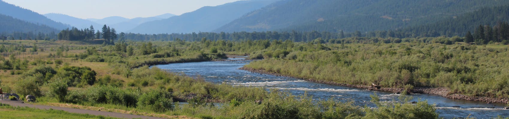
The site is located at 1744 Snowmass Drive in the Clearwater River regulated flood hazard area: Parcel 15 of COS 5140, Section 04, Township 16 North, Range 15 West, Missoula County. See location here.
The full application is available for review online or in the PDS office at 127 E. Main St., Suite 2, in Missoula.
Please feel free to call 406-258-4657 or email floodplain@missoulacounty.us with any questions or to make an appointment to review the permit application.
Public Comment
Submit comments by 5 p.m., Friday, Oct. 17, by using the comments tools below, by emailing floodplain@missoulacounty.us or mailing to Planning, Development, & Sustainability, Attn: Matt Heimel, Floodplain Administrator, 200 W. Broadway St., Missoula MT 59802.
Related Documents and Links
This permit is subject to approval by the floodplain administrator and does not go before the Board of County Commissioners.
-
Floodplain Development No. 26-14
Share Floodplain Development No. 26-14 on Facebook Share Floodplain Development No. 26-14 on X (formerly Twitter) Share Floodplain Development No. 26-14 on Linkedin Email Floodplain Development No. 26-14 linkProject Description
The Missoula County Planning, Development & Sustainability Department (PDS) has received a Floodplain Development Permit Application #26-14 from William Gaddy for repairs to a residential structure in the FEMA-designated Clark Fork River Floodway.
The site is located at 10515 Rustic Road: Parcel B, COS 1406, S34, T13N, R18W, Missoula County.

What is a floodplain development permit?
The primary purpose of the floodplain development permit is to promote public health, safety and general welfare; minimize flood losses in areas subject to flood hazards; and promote wise use of the floodplain.
Public Comment
Submit public comment by 5 p.m., Monday, May 11, through the following three methods.
- Use the comment tool below. You must be registered on Missoula County Voice
- Email floodplain@missoulacounty.us(External link)
- Mail to Planning, Development, & Sustainability
- Attn: Matt Heimel, Floodplain Administrator, 200 W. Broadway St., Missoula, MT 59802
Questions or want to make an appointment?
Residents can call 406-258-4647 or email floodplain@missoulacounty.us with any questions or to make an appointment to review the permit application.
Important Documents and Links
Department of Revenue Property Assessment
Floodplain and Shoreline Administration Webpage
Physical applications are available in the PDS office at 127 E. Main St., Suite 2 in downtown Missoula
This permit is subject to approval by the floodplain administrator and does not go before the county commissioners.
-
Petty Creek Mountain Ranch Boundary Line Relocation (Alberton)
Share Petty Creek Mountain Ranch Boundary Line Relocation (Alberton) on Facebook Share Petty Creek Mountain Ranch Boundary Line Relocation (Alberton) on X (formerly Twitter) Share Petty Creek Mountain Ranch Boundary Line Relocation (Alberton) on Linkedin Email Petty Creek Mountain Ranch Boundary Line Relocation (Alberton) linkProject description
Petty Creek Mountain Ranch LLC, represented by Marias Hale of Eli & Associates Inc., is requesting boundary line relocations involving 10 parcels to improve the layout and management of a 708-acre property. This boundary line relocation would align parcel boundaries along natural features and existing infrastructure associated with current agricultural and guest ranch operations.

What is boundary line relocation?
Boundary lines are the invisible division between properties. MCA §76.3.207(1)(a) states that a landowner has the opportunity to relocate boundary lines between adjoining properties outside of platted subdivisions. Missoula County Subdivision Regulations require any boundary line relocation involving six or more tracts of land to receive approval from the county commissioners through a public hearing process. Boundary line relocations do not result in an increase in the total number of lots and/or tracts.
Project timeline
County commissioners hearing: Thursday, June 4, 2 p.m.
- In-person location: Sophie Moiese Room, Missoula County Courthouse Annex, 200 West Broadway, Missoula
- Virtual option: Residents can attend the meeting via Microsoft Teams. To join the call on your phone, call 406-272-4824, Conference ID 467 457 758#. To join the meeting on your device, follow the links on the agenda that will be published at http://missoula.co/bccmeetings
Public comment
Let us know what you think by logging in or creating an account and submitting your comment below.
Project lead
Kevin Dantic, 406-258-4652
Important links and documents
-
Guilhemotonia Family Transfer (Mullan Rd)
Share Guilhemotonia Family Transfer (Mullan Rd) on Facebook Share Guilhemotonia Family Transfer (Mullan Rd) on X (formerly Twitter) Share Guilhemotonia Family Transfer (Mullan Rd) on Linkedin Email Guilhemotonia Family Transfer (Mullan Rd) linkProject Description
Sebastian Guilhemotonia is requesting to use the family transfer exemption from subdivision review to divide their 1-acre property, located at 7580 Arroyo Lane off Mullan Road, into two tracts (Lot 11A: .4-acres; Lot 11B: 0.6-acres). Sebastian intends to gift Lot 11A to his father, Phillipe Guilhemotonia, and keep Lot 11B as his primary residence.

Subdivision Regulations and Exemptions
Missoula County’s subdivision regulations promote public health, safety and general welfare by ensuring any subdivision of land in the County’s jurisdiction provides for adequate light, air, water supply, sewage disposal, parks and recreation areas, ingress and egress and other public requirements. Many requests to divide land must go through the subdivision process to ensure these requirements are met, but certain types of land division are exempt from subdivision review. Landowners can apply for one or multiple subdivision exemptions when their development plans meet the state and local requirements for the applicable exemptions.
Being granted these exemptions means the property owner does not need to go through the standard subdivision review process to divide their property. These requests require administrative review by planning staff and, in some cases, may require approval by the county commissioners to ensure the applicant is not evading these regulations.
- Family Transfer Exemption
Landowners can request a family transfer exemption when they intend to divide their property to gift or sell the newly created parcel(s) to an immediate family member.
View subdivision exemption criteria.
What is a family transfer?
Montana law specifically allows landowners to divide land and gift or sell one parcel per immediate family member (like a child, parent or spouse), without full subdivision review.
Requests for family transfers must always come before the commissioners. Missoula County considers dozens of family land transfers every year. It’s not rare — other counties across Montana regularly process these applications too. It’s not a loophole — it’s in the law for a reason: to help families live near each other or pass down land. It does not skirt regulations — the process requires surveys, documentation, fees and approval by county commissioners.
The landowner and recipient must be real people, not LLCs or corporations. It can only be used once per family member per county.
Project Timeline
County commissioners hearing: Thursday, May 28, 2 p.m.
- In-person location: Sophie Moiese Room, Missoula County Courthouse Annex, 200 West Broadway, Missoula
- Virtual option: Residents can attend the meeting via Microsoft Teams. To join the call on your phone, call 406-272-4824, Conference ID 467 457 758#. To join the meeting on your device, follow the links on the agenda that will be published at http://missoula.co/bccmeetings
Public Comment
Submit public comment by Wednesday, May 27, by using the comment tool below. Let us know what you think by logging in or creating an account and submitting your comment below.
Project Lead
Katy Reeder, 406-258-3707
Important Links and Documents
- Family Transfer Exemption
-
Ranch Club Subdivision Phasing Plan Extension
Share Ranch Club Subdivision Phasing Plan Extension on Facebook Share Ranch Club Subdivision Phasing Plan Extension on X (formerly Twitter) Share Ranch Club Subdivision Phasing Plan Extension on Linkedin Email Ranch Club Subdivision Phasing Plan Extension linkThe Ranch Club Subdivision phasing plan extension was granted a continuance until the May 28 public hearing meeting, at which point commissioners will make a motion to approve or deny the request. Residents are welcome to attend the May 28 public hearing meeting.
County commissioners’ public hearing meeting : Thursday, May 28, 2 p.m.
- In-person location: Sophie Moiese Room, Missoula County Courthouse Annex, 200 West Broadway, Missoula
- Virtual option: Residents can attend the meeting via Microsoft Teams. To join the call on your phone, call 406-272-4824, Conference ID 467 457 758#. To join the meeting on your device, follow the links on the agenda that will be published at http://missoula.co/bccmeetings
Project Description:
Ranch Club Investments LLC, represented by Genesis Engineering Inc., is requesting a Phasing Plan Extension of the Ranch Club Subdivision Phases 10 and 11. This subdivision was originally approved in 2003, as a phased subdivision with 323 lots, formerly known as Phantom Hills Estates.
The applicant requests the following:
- 2-year extension of the Phase 10 filing deadline to Dec. 31, 2027
- 3-year extension of the Phase 11 filing deadline to Dec. 31, 2029
These are the two remaining phases of the Ranch Club development and will consist of 52 single-family lots, 41 townhome lots and 5.55 acres of dedicated parkland.

Missoula County Subdivision Regulations Phasing Plan Extension
Missoula County Subdivision Regulations (MCSR) Section 5.8.18.4 allows extension of at least one but no more than three years from the date of the request, which applies to the entire subdivision. Final plats for all phases of a subdivision approved on or after May 8, 2017, must be submitted to review and approved, conditionally approved or denied within 20 years of the date or preliminary plat approval (MCSR) Section 5.8.18.5.B.
Project Timeline:
County commissioners’ public hearing meeting: 2 p.m. Thursday, March 26
- In-person location: 200 W. Broadway, Missoula County Courthouse, Sophie Moiese Room
- Virtual option: Residents can attend the meeting via Microsoft Teams. To join the meeting on your device, follow the links on the agenda that will be published on the Missoula County’s public meeting portal.
County commissioners’ public hearing meeting : Thursday, May 28, 2 p.m.
- In-person location: Sophie Moiese Room, Missoula County Courthouse Annex, 200 West Broadway, Missoula
- Virtual option: Residents can attend the meeting via Microsoft Teams. To join the call on your phone, call 406-272-4824, Conference ID 467 457 758#. To join the meeting on your device, follow the links on the agenda that will be published at http://missoula.co/bccmeetings
Public Comment:
Submit public comment by Wednesday, May 27 by using the comment tool below. Let us know what you think by logging in or creating an account and submitting your comment below.
Project Lead:
Kevin Dantic, 406-258-4652
Important Links and Documents:
Ranch Club Phasing Plat Extension
Planning, Development and Sustainability
-
Shelby Addition – Plat Adjustment (Lolo)
Share Shelby Addition – Plat Adjustment (Lolo) on Facebook Share Shelby Addition – Plat Adjustment (Lolo) on X (formerly Twitter) Share Shelby Addition – Plat Adjustment (Lolo) on Linkedin Email Shelby Addition – Plat Adjustment (Lolo) linkProject Description
Adam and Aubrey Wulf are requesting a plat adjustment to their property in the Shelby Addition Subdivision located at 7089 Mormon Creek Road, southwest of Lolo.
The plat adjustment is to move the designated platted area for a driveaway to a newly proposed area.
When the home was constructed, the existing driveway – now proposed for demolition – was not built within the designated access easement. The proposed driveway is relocated approximately 13 feet to the east of the existing driveway. Even though the existing driveway was built in the wrong area, the proposed driveway still requires a plat adjustment as it outside of the originally designated space for a driveway.
The new driveway would be 20 feet wide and paved.

Project Timeline
County commissioners’ public hearing: 2 p.m., Thursday, May 28.
- In-person location: Sophie Moiese Room, Missoula County Courthouse Annex, 200 West Broadway, Missoula
- Virtual option: Residents can attend the meeting via Microsoft Teams. To join the call on your phone, call 406-272-4824, Conference ID 467 457 758#. To join the meeting on your device, follow the links on the agenda that will be published at http://missoula.co/bccmeetings
Public Comment
Let us know what you think by logging in or creating an account and submitting your comment below.
Project Lead
Kevin Dantic, 406-258-4652
Important Links and Documents
Shelby Addition Plat Adjustment Application
-
Special Exception Request at 3900 South Ave. (Target Range)
Share Special Exception Request at 3900 South Ave. (Target Range) on Facebook Share Special Exception Request at 3900 South Ave. (Target Range) on X (formerly Twitter) Share Special Exception Request at 3900 South Ave. (Target Range) on Linkedin Email Special Exception Request at 3900 South Ave. (Target Range) linkProject Description:
Cody Gordon is requesting to use a special exception to construct a second single-family dwelling for their property at 3900 South Ave. W. in the Target Range area of Missoula County.

The property is currently zoned Rural Residential, Small Agriculture (RRS.5), which allows rural residential development along with the preservation of natural landscape and small-scale agriculture land uses. Only one residential unit is allowed per lot in this district.
Special Exception Information
The Board of Adjustment is authorized to grant special exception permits authorizing a use established as eligible in this district, but this requires a special degree of consideration and control to ensure such uses are consistent and compatible with the overall community character. To approve a special exception, the board must determine:
- The proposed use or development will be compatible with and will not substantially injure the value of adjoining property.
- The proposed use preserves the character of the district, and the property is suitable for the use proposed.
- The proposed use promotes the purpose and intent of the TIF Special District, where applicable. (Not applicable for this project, as the property is not located within a TIF District.)
- Substitute or additional design standards will preserve and protect the area’s architectural and aesthetic qualities.
In reviewing a special exception application, the board shall give due consideration to the following factors in determining if the use is appropriate:
- Access, traffic and parking demand created by or impacted by the use, and pedestrian, bicycle and onsite vehicular circulation.
- Dedication and development of streets, right-of-way, and public use areas, such as sidewalks adjoining the property and the capacity to handle the use.
- Impacts on or of public and private utilities or services.
- Proposed location of any new structures necessary to accommodate the use and their relationship to adjoining and surrounding properties.
- Recreation opportunities and open lands available to serve the use.
- Natural resource protections.
- Landscaping and screening requirements.
- Signage and sign lighting, as applicable.
- Noise, vibration, outdoor lighting and other on- and off-site impacts resulting from the use.
- Frequency of use and hours of operation.
- Area of land necessary and adequacy of the site to accommodate the use and meet the intent of the district and character of the neighborhood.
- Any other unique or relevant circumstances related to the property.
Project Timeline
Missoula County Consolidated Land Use Board meeting: 6 p.m. Wednesday, May 6.
- In-person location: Sophie Moiese Room, Missoula County Courthouse Annex, 200 West Broadway, Missoula
- Virtual option: Residents can attend the meeting via Microsoft Teams. To join the call on your phone, call 406-272-4824, Conference ID 115 075 404#. To join the meeting on your device, follow the links on the agenda that will be published at http://missoula.co/mcclubmeetings.
Public Comment
Let us know what you think by logging in or creating an account and submitting your comment below.
Project Lead
Kevin Dantic, 406-258-4652
Important Links and Documents
-
Special Exception Request at 1716 Clements Road (Target Range)
Share Special Exception Request at 1716 Clements Road (Target Range) on Facebook Share Special Exception Request at 1716 Clements Road (Target Range) on X (formerly Twitter) Share Special Exception Request at 1716 Clements Road (Target Range) on Linkedin Email Special Exception Request at 1716 Clements Road (Target Range) linkProject Description
Melody Bryan is requesting to use a special exception to construct a second single-family dwelling for her property at 1716 Clements Road in the Target Range area of Missoula.

The property is currently zoned Rural Residential, Small Agriculture (RRS.5), which allows rural residential development along with the preservation of natural landscape and small-scale agriculture land uses. Only one residential unit is allowed per lot in this district.
Special Exception Information
The Board of Adjustment is authorized to grant special exception permits authorizing a use established as eligible in this district, but this requires a special degree of consideration and control to ensure such uses are consistent and compatible with the overall community character. To approve a special exception, the board must determine:
- The proposed use or development will be compatible with and will not substantially injure the value of adjoining property.
- The proposed use preserves the character of the district, and the property is suitable for the use proposed.
- The proposed use promotes the purpose and intent of the TIF Special District, where applicable. (Not applicable for this project, as the property is not located within a TIF District.)
- Substitute or additional design standards will preserve and protect the area’s architectural and aesthetic qualities.
In reviewing a special exception application, the board shall give due consideration to the following factors in determining if the use is appropriate:
- Access, traffic and parking demand created by or impacted by the use, and pedestrian, bicycle and onsite vehicular circulation.
- Dedication and development of streets, right-of-way, and public use areas, such as sidewalks adjoining the property and the capacity to handle the use.
- Impacts on or of public and private utilities or services.
- Proposed location of any new structures necessary to accommodate the use and their relationship to adjoining and surrounding properties.
- Recreation opportunities and open lands available to serve the use.
- Natural resource protections.
- Landscaping and screening requirements.
- Signage and sign lighting, as applicable.
- Noise, vibration, outdoor lighting and other on- and off-site impacts resulting from the use.
- Frequency of use and hours of operation.
- Area of land necessary and adequacy of the site to accommodate the use and meet the intent of the district and character of the neighborhood.
- Any other unique or relevant circumstances related to the property.
Project Timeline
Missoula County Consolidated Land Use Board meeting: 6 p.m. Wednesday, May 6.
- In-person location: Sophie Moiese Room, Missoula County Courthouse Annex, 200 West Broadway, Missoula
- Virtual option: Residents can attend the meeting via Microsoft Teams. To join the call on your phone, call 406-272-4824, Conference ID 115 075 404#. To join the meeting on your device, follow the links on the agenda that will be published at http://missoula.co/mcclubmeetings.
Public Comment
Let us know what you think by logging in or creating an account and submitting your comment below.
Project Lead
Kevin Dantic, 406-258-4652
Important Links and Documents:
-
Bowman Family Transfer (Frenchtown)
Share Bowman Family Transfer (Frenchtown) on Facebook Share Bowman Family Transfer (Frenchtown) on X (formerly Twitter) Share Bowman Family Transfer (Frenchtown) on Linkedin Email Bowman Family Transfer (Frenchtown) linkSharon Bowman is requesting to use the family transfer exemption from subdivision review to divide their 7-acre property at 15098 Bud Lake Drive in Frenchtown into two tracts (Lot A1: 4.12 acres; Lot A2: 2.88 acres). Bowman plans to gift Lot A2 to her son Joshua and keep Lot A1 as their primary residence.

Subdivision Regulations and Exemptions:
Missoula County’s subdivision regulations promote public health, safety and general welfare by ensuring any subdivision of land in the County’s jurisdiction provides for adequate light, air, water supply, sewage disposal, parks and recreation areas, ingress and egress and other public requirements. Many requests to divide land must go through the subdivision process to ensure these requirements are met, but certain types of land division are exempt from subdivision review. Landowners can apply for one or multiple subdivision exemptions when their development plans meet the state and local requirements for the applicable exemptions.
Being granted these exemptions means the property owner does not need to go through the standard subdivision review process to divide their property. These requests require administrative review by planning staff and, in some cases, may require approval by the county commissioners to ensure the applicant is not evading these regulations.
- Family Transfer Exemption
Landowners can request a family transfer exemption when they intend to divide their property to gift or sell the newly created parcel(s) to an immediate family member.
View subdivision exemption criteria.
What is a family transfer?
Montana law specifically allows landowners to divide land and gift or sell one parcel per immediate family member (like a child, parent or spouse), without full subdivision review.
Requests for family transfers must always come before the commissioners. Missoula County considers dozens of family land transfers every year. It’s not rare — other counties across Montana regularly process these applications too. It’s not a loophole — it’s in the law for a reason: to help families live near each other or pass down land. It’s does not skirt regulations — the process requires surveys, documentation, fees and approval by county commissioners.
The landowner and recipient must be real people, not LLCs or corporations. It can only be used once per family member per county.
Project Timeline:
County commissioners hearing: Thursday, April 30, 2 p.m.
- In-person location: Sophie Moiese Room, Missoula County Courthouse Annex, 200 West Broadway, Missoula
- Virtual option: Residents can attend the meeting via Microsoft Teams. To join the call on your phone, call 406-272-4824, Conference ID 467 457 758#. To join the meeting on your device, follow the links on the agenda that will be published at http://missoula.co/bccmeetings
Public Comment:
Submit public comment by Wednesday, April 29 by using the comment tool below. Let us know what you think by logging in or creating an account and submitting your comment below.
Project Lead:
Jennie Dixon, 406-258-4946
Important Links and Documents:
- Family Transfer Exemption
-
Larch Meadows Minor Subdivision (Huson)
Share Larch Meadows Minor Subdivision (Huson) on Facebook Share Larch Meadows Minor Subdivision (Huson) on X (formerly Twitter) Share Larch Meadows Minor Subdivision (Huson) on Linkedin Email Larch Meadows Minor Subdivision (Huson) linkProject Description:
This is a request from Mountain Construction, Inc, represented by 406 Engineering, to subdivide a 12.31-acre parcel into three residential lots located at 31725 Ranch Lane in Huson. The proposed lots are roughly four acres each, with each lot intended for a single-family residence.

As part of this development, there will be new driveways along the existing roads to access each of the lots. There will be no changes to the existing road system and there are no proposed roads or non-motorized facilities as part of the development’s proposal.
The property is currently in an unzoned area of Missoula County. The Land Use Designation map from Missoula County Growth Policy recommends Open and Resource land designation for this property and for most of Ninemile Valley, however, similar developments like this are scattered across the valley. Water for this subdivision will be provided by individual wells. Well logs show a yield of 20 gallons per minute, approximately 35 feet below the ground surface. Sewer will be provided by individual drain fields on each lot. These will be designed and constructed per Montana Department of Environmental Quality Circular -4 and Missoula County Regulations. Stormwater will be retained by landscaping and retention ponds located on site.
Subdivision Regulations
Missoula County’s subdivision regulations promote public health, safety and general welfare by ensuring any subdivision of land in the County’s jurisdiction provides for adequate light, air, water supply, sewage disposal, parks and recreation areas, ingress and egress and other public requirements. A subdivision is considered “minor” when it has five or fewer lots.
Staff consider the following when making a recommendation to the county commissioners on whether to approve or deny a subdivision request:
- compliance with zoning and the Growth Policy
- effects on agriculture and agricultural water user facilities, local services, the natural environment, wildlife, and wildlife habitat and public health and safety
- compliance with survey requirements established in state statute, and local subdivision regulations and review procedures
- provision of necessary easements and other legal and physical access
Project Timeline:
County commissioners’ public hearing meeting: 2 p.m. Thursday, April 9
- In-person location: 200 W. Broadway, Missoula County Courthouse, Sophie Moiese Room
- Virtual option: Residents can attend the meeting via Microsoft Teams. To join the meeting on your device, follow the links on the agenda that will be published on the Missoula County’s public meeting portal.
Public Comment:
Submit public comment by Wednesday, April 8, using the comment tool below.
Project Lead:
Katy Reeder, 406-258-3707
Important Links and Documents:
Larch Meadows Minor Subdivision Application
Planning, Development and Sustainability
